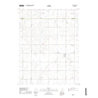
2018 Map of Tampa
USGS Topo · Published 2018About this map
The town of Tampa serves as the central hub of this agricultural landscape in Marion County, where the grid of rural roads meets the branching tributaries of the Cottonwood River system. The township lines of t17s r2e and t17s r3e define a region shaped by its watercourses, including W Turkey Cr, Middle Br, and Mud Cr. These streams cut through the plains, creating the varied topography that dictated early settlement patterns and the placement of local homesteads.
Find a feature on this map
40 named features on this map. Tap any name to fly to it.
Don’t see what you’re looking for? This feature index may not catch every label — zoom into the map to look around manually.
Map Details
Editions of this 2018 Tampa Map
This is the sole edition of this map. No revisions or reprints were ever made.
Other maps of this area

1889 · Newton
USGS Topo · 1:125,000

1889 · Abilene
USGS Topo · 1:125,000

1894 · Newton
USGS Topo · 1:125,000

1894 · Abilene
USGS Topo · 1:125,000

1955 · Hutchinson
USGS Topo · 1:250,000

1959 · Hutchinson
USGS Topo · 1:250,000

1964 · Elmo
USGS Topo · 1:24,000

1964 · Carlton
USGS Topo · 1:24,000

1964 · Ramona
USGS Topo · 1:24,000
1964 · Hope
USGS Topo · 1:24,000