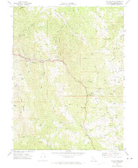
1969 Map of Tan Oak Park
USGS Topo · Published 1974About this map
Rattlesnake Creek and Tenmile Creek carve deep through this Mendocino County landscape, where the winding path of U.S. 101 provides the primary corridor for travel near Tan Oak Park. In the late 1960s, this area remained largely defined by high ridges and family-held land, evidenced by named locations such as Bald Mtn Ranch, Redwink Ranch, and the Bowman Place. The geography is shaped by prominent elevations like Mad Ridge and Cow Mtn, with a network of Jeep Trails and Trails extending into the back country. Small-scale human presence is marked by a Gaging Station on the water and the Empire Roadside Rest, showing the reliance on the highway as it threads between Rattlesnake Summit and Grapevine. Local industry is subtly noted by a Borrow Pit near Twin Rocks Creek, while the presence of Camp Seabow indicates the region's use for seasonal recreation or organized retreats.
Find a feature on this map
39 named features on this map. Tap any name to fly to it.
Don’t see what you’re looking for? This feature index may not catch every label — zoom into the map to look around manually.
Map Details
Editions of this 1969 Tan Oak Park Map
3 editions found
Other maps of this area

1920 · Cummings
USGS Topo · 1:62,500

1920 · Covelo
USGS Topo · 1:62,500

1921 · Branscomb
USGS Topo · 1:62,500

1951 · Branscomb
USGS Topo · 1:62,500

1951 · Laytonville
USGS Topo · 1:62,500

1952 · Spyrock
USGS Topo · 1:62,500

1952 · Leggett
USGS Topo · 1:62,500

1957 · Ukiah
USGS Topo · 1:250,000

1960 · Ukiah
USGS Topo · 1:250,000
1966 · Lincoln Ridge
USGS Topo · 1:24,000