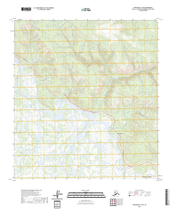
2024 Map of Tanacross A-2 SW
USGS Topo · Published 2024About this map
The confluence of three major glacial rivers dominates this interior Alaskan landscape, where the Tanana River, Nabesna River, and Chisana River converge amidst a vast network of wetlands. Much of the southern half of the sheet is protected within the Tetlin National Wildlife Refuge, a critical habitat defined by winding waterways and seasonal floodplains. The settlement of Northway and the nearby Northway Junction serve as the primary human hubs, situated where the Alaska Highway and Northway Road intersect. To the north, the terrain rises toward Cheneathda Hill, providing a stark contrast to the low-lying marshes. Smaller tributaries like Moose Creek and Beaver Creek thread through the brush, illustrating the complex hydrography of the Southeast Fairbanks region.
Find a feature on this map
18 named features on this map. Tap any name to fly to it.
Don’t see what you’re looking for? This feature index may not catch every label — zoom into the map to look around manually.
Map Details
Editions of this 2024 Tanacross A-2 SW Map
This is the sole edition of this map. No revisions or reprints were ever made.
Other maps of this area

1948 · Tanacross A-3
USGS Topo · 1:63,360

1949 · Tanacross
USGS Topo · 1:250,000

1950 · Tanacross
USGS Topo · 1:250,000

1950 · Nabesna
USGS Topo · 1:250,000

1951 · Nabesna
USGS Topo · 1:250,000

1952 · Tanacross A-3
USGS Topo · 1:63,360

1954 · Tanacross A-2
USGS Topo · 1:63,360

1954 · Nabesna D-2
USGS Topo · 1:63,360

1954 · Nabesna D-3
USGS Topo · 1:63,360

1955 · Nabesna D-3
USGS Topo · 1:63,360