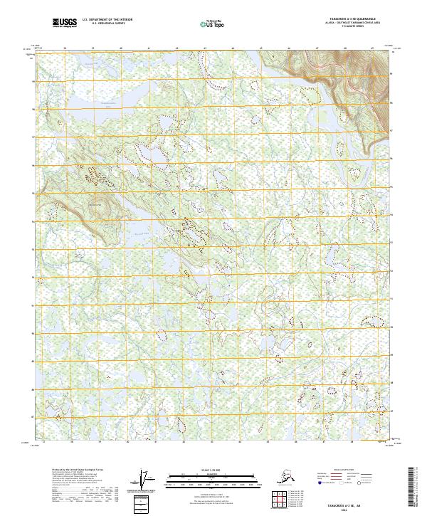
2024 Map of Tanacross A-3 SE
USGS Topo · Published 2024About this map
The Tetlin National Wildlife Refuge encompasses this interior Alaskan landscape, dominated by an intricate network of wetlands and meandering waterways. The Tanana River cuts through the northern portion of the map, while the Kalutna River winds through the southwestern reaches. The terrain is characterized by numerous water bodies, including Nuziamundcho Lake, Tsilchin Lake, and Big John Lake, the latter situated near the prominence of Big John Hill. Human impact is limited to the corridor of the Alaska Highway, which skirts the northeastern corner. This configuration of drainage and elevation reveals a landscape largely shaped by glacial activity and permafrost, where subtle changes in topography dictate the placement of essential transport routes like the highway above the surrounding marshlands.
Find a feature on this map
14 named features on this map. Tap any name to fly to it.
Don’t see what you’re looking for? This feature index may not catch every label — zoom into the map to look around manually.
Map Details
Editions of this 2024 Tanacross A-3 SE Map
This is the sole edition of this map. No revisions or reprints were ever made.
Other maps of this area

1948 · Tanacross A-3
USGS Topo · 1:63,360

1949 · Tanacross
USGS Topo · 1:250,000

1950 · Tanacross
USGS Topo · 1:250,000

1950 · Nabesna
USGS Topo · 1:250,000

1951 · Nabesna
USGS Topo · 1:250,000

1952 · Tanacross A-3
USGS Topo · 1:63,360

1954 · Tanacross A-2
USGS Topo · 1:63,360

1954 · Nabesna D-2
USGS Topo · 1:63,360

1954 · Nabesna D-3
USGS Topo · 1:63,360

1955 · Nabesna D-3
USGS Topo · 1:63,360