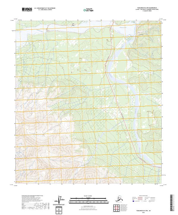
2024 Map of Tanacross B-6 NW
USGS Topo · Published 2024About this map
The Tanana River and Robertson River converge in this Interior Alaska landscape, creating a wide riparian corridor of wetlands and shifting channels. The small settlement of Dot Lake is positioned north of the Robertson, serving as a focal point for the region’s sparse human footprint. Modern transportation follows the historic corridor of the Alaska Highway, which runs along the base of the rising highlands to the west. This 2024 survey illustrates the complex drainage systems of Sheep Creek and Cathedral Rapids Creek Number 2 as they flow from the high elevation down toward the river valley. The prominent Tower Bluffs overlook the Tanana, providing a distinct landmark in an area defined by its glacial river network and the transition from river plains to significant mountain slopes.
Find a feature on this map
14 named features on this map. Tap any name to fly to it.
Don’t see what you’re looking for? This feature index may not catch every label — zoom into the map to look around manually.
Map Details
Editions of this 2024 Tanacross B-6 NW Map
This is the sole edition of this map. No revisions or reprints were ever made.
Other maps of this area

1949 · Tanacross
USGS Topo · 1:250,000

1949 · Tanacross B-6
USGS Topo · 1:63,360

1950 · Tanacross
USGS Topo · 1:250,000

1950 · Mount Hayes
USGS Topo · 1:250,000

1951 · Mount Hayes
USGS Topo · 1:250,000

1951 · Tanacross B-6
USGS Topo · 1:63,360

1954 · Mount Hayes B-1
USGS Topo · 1:63,360

1954 · Tanacross C-6
USGS Topo · 1:63,360

1954 · Mount Hayes C-1
USGS Topo · 1:63,360

1955 · Mount Hayes C-1
USGS Topo · 1:63,360