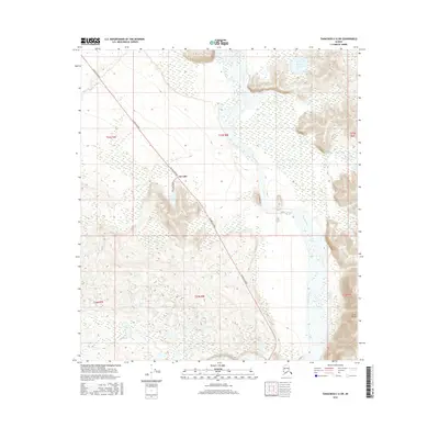
2016 Map of Tanacross C-6 SW
USGS Topo · Published 2016About this map
Dot Lake serves as the primary human landmark in this region of the Interior, situated along the vital corridor of the Alaska Highway. The landscape is dominated by the braided course of the Tanana River, which flows through the eastern portion of the map. Navigation along the water is marked by the presence of Tower Bluff Rapids and the prominent Tower Bluffs, indicating a shift in the river's character as it passes through the terrain. Away from the main river valley, the area is punctuated by smaller bodies of water such as Round Lake and Jan Lake, the latter of which is accessible via Jan Lake Road. The survey illustrates the intersection of modern transportation routes with the natural hydrological systems that have historically dictated movement and settlement in the Alaskan wilderness.
Find a feature on this map
14 named features on this map. Tap any name to fly to it.
Don’t see what you’re looking for? This feature index may not catch every label — zoom into the map to look around manually.
Map Details
Editions of this 2016 Tanacross C-6 SW Map
This is the sole edition of this map. No revisions or reprints were ever made.
Other maps of this area

1949 · Tanacross
USGS Topo · 1:250,000

1949 · Tanacross B-6
USGS Topo · 1:63,360

1950 · Tanacross
USGS Topo · 1:250,000

1950 · Mount Hayes
USGS Topo · 1:250,000

1951 · Mount Hayes
USGS Topo · 1:250,000

1951 · Tanacross B-6
USGS Topo · 1:63,360

1954 · Mount Hayes B-1
USGS Topo · 1:63,360

1954 · Tanacross C-6
USGS Topo · 1:63,360

1954 · Mount Hayes C-1
USGS Topo · 1:63,360

1955 · Mount Hayes C-1
USGS Topo · 1:63,360