
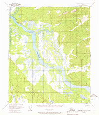
1952 Map of Tanana A-2
USGS Topo · Published 1956About this map
Manley Hot Springs serves as the primary hub in this interior Alaska landscape, situated at the southern edge of a region defined by high ridges and gold-bearing drainage systems. The map illustrates the industrial infrastructure of the early 1950s, where an extensive network of a Ditch system was used for hydraulic mining operations along Sullivan Creek and Quartz Creek. These man-made waterways carve through the hillsides below Roughtop Mountain, feeding into numerous gulches like Harter Gulch and Dalton Gulch.
Find a feature on this map
43 named features on this map. Tap any name to fly to it.
Don’t see what you’re looking for? This feature index may not catch every label — zoom into the map to look around manually.
Map Details
Editions of this 1952 Tanana A-2 Map
This is the sole edition of this map. No revisions or reprints were ever made.
Other maps of this area

1948 · Kantishna River
USGS Topo · 1:250,000

1951 · Kantishna River
USGS Topo · 1:250,000

1951 · Tanana
USGS Topo · 1:250,000

1952 · Tanana A-1
USGS Topo · 1:63,360

1952 · Tanana A-3
USGS Topo · 1:63,360

1952 · Kantishna River
USGS Topo · 1:250,000

1952 · Kantishna River D-2
USGS Topo · 1:63,360

1952 · Kantishna River D-3
USGS Topo · 1:63,360

1953 · Tanana A-2
USGS Topo · 1:63,360
1953 · Kantishna River D-1
USGS Topo · 1:63,360