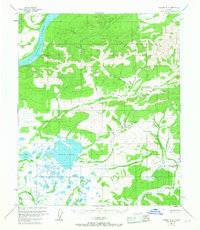
1953 Map of Tanana A-3
USGS Topo · Published 1967About this map
The Yukon River carves through the northwestern corner of this territory, where the interior Alaskan landscape is defined by an intricate network of drainages and early industrial infrastructure. In the 1950s, the region around Fish Lake and American Creek supported active mining operations, evidenced by labels for a Placer Mine, extensive Tailings, and a Ditch system designed to move water for hydraulic mining. A network of Tractor Trails provides the primary overland transport through the valley of Boulder Creek and down toward Woodchopper Creek. Named gulches such as Colorado Gulch, California Gulch, and New York Gulch suggest a history of prospecting and localized settlement, while a small Cabin and a designated Landing Area mark the sparse human footprint in this wilderness.
Find a feature on this map
36 named features on this map. Tap any name to fly to it.
Don’t see what you’re looking for? This feature index may not catch every label — zoom into the map to look around manually.
Map Details
Editions of this 1953 Tanana A-3 Map
2 editions found

Other maps of this area

1948 · Kantishna River
USGS Topo · 1:250,000

1951 · Kantishna River
USGS Topo · 1:250,000

1951 · Tanana
USGS Topo · 1:250,000

1952 · Tanana A-3
USGS Topo · 1:63,360

1952 · Tanana A-2
USGS Topo · 1:63,360

1952 · Tanana A-4
USGS Topo · 1:63,360

1952 · Kantishna River
USGS Topo · 1:250,000

1952 · Kantishna River D-2
USGS Topo · 1:63,360

1952 · Kantishna River D-3
USGS Topo · 1:63,360

1953 · Tanana A-2
USGS Topo · 1:63,360