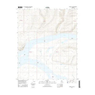
2016 Map of Tanana A-4 NW
USGS Topo · Published 2016About this map
Tanana stands at the western edge of this 2016 survey, situated near the confluence of two of Alaska's most significant interior waterways. The landscape is defined by the braided channels and seasonal shifts of the Yukon River and the Tanana River, which dominate the central and southern portions of the map. These rivers have created a complex network of sloughs and alluvial islands, including Sixmile Island, Twelvemile Island, and Eightmile Island, each named for their distance along the river corridor.
Find a feature on this map
27 named features on this map. Tap any name to fly to it.
Don’t see what you’re looking for? This feature index may not catch every label — zoom into the map to look around manually.
Map Details
Editions of this 2016 Tanana A-4 NW Map
This is the sole edition of this map. No revisions or reprints were ever made.
Other maps of this area

1951 · Tanana
USGS Topo · 1:250,000

1952 · Tanana A-4
USGS Topo · 1:63,360

1952 · Tanana A-5
USGS Topo · 1:63,360

1953 · Tanana A-5
USGS Topo · 1:63,360

1956 · Tanana B-5
USGS Topo · 1:63,360

1956 · Tanana B-4
USGS Topo · 1:63,360

1956 · Tanana
USGS Topo · 1:250,000

1960 · Tanana
USGS Topo · 1:250,000
2016 · Tanana B-4 SE
USGS Topo · 1:25,000
2016 · Tanana A-5 SE
USGS Topo · 1:25,000