
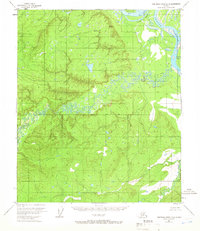
1952 Map of Tanana A-5
USGS Topo · Published 1957About this map
The settlement of Tanana occupies a strategic position at the confluence of the mighty Yukon River and several significant waterways in the Alaskan interior. This 1950s record documents a critical transportation hub during the transition from traditional river-and-trail movement to modern aviation. The presence of a Sled Trail and Tractor Trail highlights the importance of overland winter routes, while the Tanana Airport, Tanana Beacon, and Radio Towers signify the growing reliance on air travel.
Find a feature on this map
31 named features on this map. Tap any name to fly to it.
Don’t see what you’re looking for? This feature index may not catch every label — zoom into the map to look around manually.
Map Details
Editions of this 1952 Tanana A-5 Map
This is the sole edition of this map. No revisions or reprints were ever made.
Other maps of this area

1948 · Kantishna River
USGS Topo · 1:250,000

1951 · Kantishna River
USGS Topo · 1:250,000

1951 · Tanana
USGS Topo · 1:250,000

1952 · Tanana A-4
USGS Topo · 1:63,360

1952 · Kantishna River D-5
USGS Topo · 1:63,360

1952 · Kantishna River
USGS Topo · 1:250,000

1952 · Tanana A-6
USGS Topo · 1:63,360

1952 · Kantishna River D-6
USGS Topo · 1:63,360
1953 · Kantishna River D-5
USGS Topo · 1:63,360

1953 · Tanana A-5
USGS Topo · 1:63,360