
1953 Map of Tanana A-5
USGS Topo · Published 1967About this map
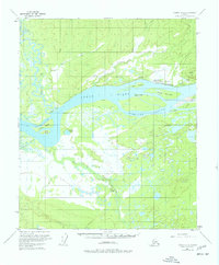
The confluence of the Yukon River and the Tozitna River defines this subarctic landscape in the early 1950s. The settlement of Tanana sits prominently on the north bank of the Yukon, serving as a vital transportation hub with the Tanana Airport Tanapod Beacon and a secondary Landing Strip (Alaska) nearby. The terrain is characterized by a complex network of waterways, including Tozitna Slough and Corbusier Slough, which weave around substantial landmasses like Bull Island and Long Island.
Find a feature on this map
35 named features on this map. Tap any name to fly to it.
Don’t see what you’re looking for? This feature index may not catch every label — zoom into the map to look around manually.
Map Details
Editions of this 1953 Tanana A-5 Map
2 editions found
Other maps of this area

1948 · Kantishna River
USGS Topo · 1:250,000

1951 · Kantishna River
USGS Topo · 1:250,000

1951 · Tanana
USGS Topo · 1:250,000

1952 · Tanana A-4
USGS Topo · 1:63,360

1952 · Kantishna River D-5
USGS Topo · 1:63,360

1952 · Kantishna River
USGS Topo · 1:250,000

1952 · Tanana A-6
USGS Topo · 1:63,360

1952 · Kantishna River D-6
USGS Topo · 1:63,360

1952 · Tanana A-5
USGS Topo · 1:63,360
1953 · Kantishna River D-5
USGS Topo · 1:63,360