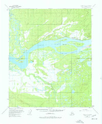
1953 Map of Tanana A-5
USGS Topo · Published 1977About this map
Tanana sits at the vital confluence where the Tanana River meets the Yukon River, a location traditionally significant for transport and trade. This survey, based on 1952 aerial photography and 1953 field data, shows the community anchored by Mission Hill and served by the Ralph M Calhoun Memorial Airport. The map captures a landscape defined by shifting waterways and seasonal routes, featuring an extensive network of islands and sloughs such as Corbusier Slough and Tozitna Slough.
Find a feature on this map
30 named features on this map. Tap any name to fly to it.
Don’t see what you’re looking for? This feature index may not catch every label — zoom into the map to look around manually.
Map Details
Editions of this 1953 Tanana A-5 Map
2 editions found

Other maps of this area

1948 · Kantishna River
USGS Topo · 1:250,000

1951 · Kantishna River
USGS Topo · 1:250,000

1951 · Tanana
USGS Topo · 1:250,000

1952 · Tanana A-4
USGS Topo · 1:63,360

1952 · Kantishna River D-5
USGS Topo · 1:63,360

1952 · Kantishna River
USGS Topo · 1:250,000

1952 · Tanana A-6
USGS Topo · 1:63,360

1952 · Kantishna River D-6
USGS Topo · 1:63,360

1952 · Tanana A-5
USGS Topo · 1:63,360
1953 · Kantishna River D-5
USGS Topo · 1:63,360