
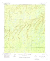
1952 Map of Kantishna River D-6
USGS Topo · Published 1957About this map
Boney Creek and its tributary, Little Boney Creek, dominate this interior Alaskan landscape in the Fourth Judicial Division as it appeared in the early 1950s. The map illustrates a dense network of muskeg and wetlands, characterized by hundreds of small lakes and ponds scattered across the low-lying terrain. This 1:63,360 scale survey provides a detailed look at the drainage patterns of the Boney Creek basin before any modern development or roads reached this segment of the Yukon-Koyukuk region. The absence of named human settlements or structures underscores the wilderness character of the area, where the complex aquatic system and subtle elevation shifts are the primary features of interest for those studying the historical natural geography of the Kantishna River vicinity.
Find a feature on this map
2 named features on this map. Tap any name to fly to it.
Don’t see what you’re looking for? This feature index may not catch every label — zoom into the map to look around manually.
Map Details
Editions of this 1952 Kantishna River D-6 Map
2 editions found
Other maps of this area

1948 · Kantishna River
USGS Topo · 1:250,000

1951 · Kantishna River
USGS Topo · 1:250,000

1951 · Ruby
USGS Topo · 1:250,000

1951 · Melozitna
USGS Topo · 1:250,000

1951 · Tanana
USGS Topo · 1:250,000

1952 · Kantishna River C-5
USGS Topo · 1:63,360

1952 · Ruby C-1
USGS Topo · 1:63,360

1952 · Kantishna River C-6
USGS Topo · 1:63,360

1952 · Kantishna River D-5
USGS Topo · 1:63,360

1952 · Ruby D-1
USGS Topo · 1:63,360