
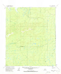
1952 Map of Ruby D-1
USGS Topo · Published 1957About this map
The Little Mud River and its complex network of tributaries define this interior Alaskan landscape as it was documented in the early 1950s. The terrain is characterized by winding watercourses and isolated landmarks, such as the VABM 1694 Mud and VABM Cache 856 survey points. A single Cabin near Bering Creek represents the only named structure in this expansive wilderness, suggesting a landscape primarily shaped by natural drainage patterns rather than permanent settlement. The Klataslo River and Blind River cut through the topography, illustrating the hydrologic character of the Ruby quadrangle during an era when much of the region remained accessible only by river or air, long before significant human infrastructure altered the environment.
Find a feature on this map
7 named features on this map. Tap any name to fly to it.
Don’t see what you’re looking for? This feature index may not catch every label — zoom into the map to look around manually.
Map Details
Editions of this 1952 Ruby D-1 Map
2 editions found
Other maps of this area

1948 · Kantishna River
USGS Topo · 1:250,000

1951 · Kantishna River
USGS Topo · 1:250,000

1951 · Ruby
USGS Topo · 1:250,000

1951 · Melozitna
USGS Topo · 1:250,000

1951 · Tanana
USGS Topo · 1:250,000

1952 · Ruby C-1
USGS Topo · 1:63,360

1952 · Kantishna River C-6
USGS Topo · 1:63,360

1952 · Melozitna A-2
USGS Topo · 1:63,360

1952 · Ruby C-2
USGS Topo · 1:63,360

1952 · Kantishna River
USGS Topo · 1:250,000