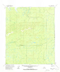
1952 Map of Ruby D-1
USGS Topo · Published 1972About this map
Meandering watercourses define this interior Alaskan landscape, dominated by the serpentine paths of the Little Mud River and the Klataslo River. Surveyed in the early 1950s using photogrammetric methods, the terrain is characterized by intricate drainage patterns and marshy lowlands where Bering Creek and Blind River flow through sections of the Kateel River Meridian. A single Cabin stands as a rare sign of human presence in this expansive wilderness, while geodetic markers like VABM 1694 Mud and VABM Cache 856 provide the primary fixed points for navigating the topography. The map captures a moment before modern development, showing the land as a system of unsurveyed and unmarked locations predetermined by the Bureau of Land Management.
Find a feature on this map
9 named features on this map. Tap any name to fly to it.
Don’t see what you’re looking for? This feature index may not catch every label — zoom into the map to look around manually.
Map Details
Editions of this 1952 Ruby D-1 Map
2 editions found
Other maps of this area

1948 · Kantishna River
USGS Topo · 1:250,000

1951 · Kantishna River
USGS Topo · 1:250,000

1951 · Ruby
USGS Topo · 1:250,000

1951 · Melozitna
USGS Topo · 1:250,000

1951 · Tanana
USGS Topo · 1:250,000

1952 · Ruby C-1
USGS Topo · 1:63,360

1952 · Kantishna River C-6
USGS Topo · 1:63,360

1952 · Melozitna A-2
USGS Topo · 1:63,360

1952 · Ruby D-1
USGS Topo · 1:63,360

1952 · Ruby C-2
USGS Topo · 1:63,360