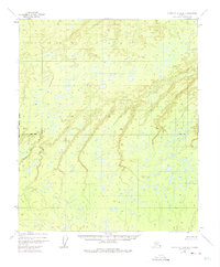
1952 Map of Kantishna River D-6
USGS Topo · Published 1974About this map
Boney Creek meanders through this interior Alaskan landscape, defining the local drainage patterns across a complex network of wetlands and small lakes. Recorded through aerial photography in the early 1950s, the terrain shows a vast, undeveloped expanse of the Fairbanks Meridian, where the Base Line serves as a primary surveying marker. The map illustrates the characteristic swampy lowlands of the Yukon-Koyukuk region, punctuated by the winding course of Little Bear Creek. This survey reflects the systematic effort by the Bureau of Land Management and Geological Survey to chart the remote interior without field-checking every acre, relying instead on photogrammetric methods to capture the intricate hydrography and elevation contours of the territory.
Find a feature on this map
4 named features on this map. Tap any name to fly to it.
Don’t see what you’re looking for? This feature index may not catch every label — zoom into the map to look around manually.
Map Details
Editions of this 1952 Kantishna River D-6 Map
2 editions found

Other maps of this area

1948 · Kantishna River
USGS Topo · 1:250,000

1951 · Kantishna River
USGS Topo · 1:250,000

1951 · Ruby
USGS Topo · 1:250,000

1951 · Melozitna
USGS Topo · 1:250,000

1951 · Tanana
USGS Topo · 1:250,000

1952 · Kantishna River C-5
USGS Topo · 1:63,360

1952 · Ruby C-1
USGS Topo · 1:63,360

1952 · Kantishna River C-6
USGS Topo · 1:63,360

1952 · Kantishna River D-5
USGS Topo · 1:63,360

1952 · Ruby D-1
USGS Topo · 1:63,360