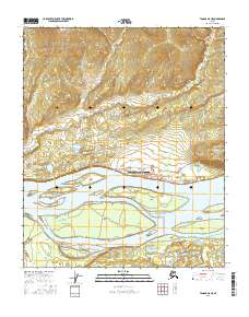
2016 Map of Tanana A-5 NE
USGS Topo · Published 2016About this map
The Yukon River dominates this landscape, carving a wide path through the Interior region where the river system defines local life and travel. The settlement of Tanana is situated on the north bank, serving as a hub near the confluence of major waterways. This 2016 survey highlights the community's critical infrastructure, including the Ralph M Calhoun Memorial Airport and a local street grid featuring First Avenue and Mission Hill Road.
Find a feature on this map
25 named features on this map. Tap any name to fly to it.
Don’t see what you’re looking for? This feature index may not catch every label — zoom into the map to look around manually.
Map Details
Editions of this 2016 Tanana A-5 NE Map
This is the sole edition of this map. No revisions or reprints were ever made.
Other maps of this area

1951 · Tanana
USGS Topo · 1:250,000

1952 · Tanana A-4
USGS Topo · 1:63,360

1952 · Tanana A-5
USGS Topo · 1:63,360

1953 · Tanana A-5
USGS Topo · 1:63,360

1956 · Tanana B-5
USGS Topo · 1:63,360

1956 · Tanana B-4
USGS Topo · 1:63,360

1956 · Tanana
USGS Topo · 1:250,000

1960 · Tanana
USGS Topo · 1:250,000
2016 · Tanana A-5 SE
USGS Topo · 1:25,000
2016 · Tanana B-5 SW
USGS Topo · 1:25,000