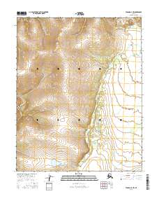
2016 Map of Tanana D-3 NW
USGS Topo · Published 2016About this map
Kanuti-Kilolitna River winds through the northern reaches of this interior Alaskan landscape, serving as a primary drainage point for the high ridges that define the terrain. The map reveals a rugged topography marked by steep elevation changes, particularly in the western sections where unnamed peaks reach significant heights. Waterways like Torment Cr and Kishilitna Cr provide a look at the natural drainage patterns that have shaped the region long before modern surveying. This 2016 record from the U.S. Geological Survey captures a wilderness defined by its absence of road infrastructure, emphasizing the isolation of the Yukon-Koyukuk region. Researchers can trace the complex contour lines to understand the physical barriers that dictate movement through this subarctic environment.
Find a feature on this map
9 named features on this map. Tap any name to fly to it.
Don’t see what you’re looking for? This feature index may not catch every label — zoom into the map to look around manually.
Map Details
Editions of this 2016 Tanana D-3 NW Map
This is the sole edition of this map. No revisions or reprints were ever made.
Other maps of this area

1951 · Bettles
USGS Topo · 1:250,000

1951 · Tanana
USGS Topo · 1:250,000

1956 · Bettles
USGS Topo · 1:250,000

1956 · Tanana D-4
USGS Topo · 1:63,360

1956 · Tanana D-3
USGS Topo · 1:63,360

1956 · Tanana
USGS Topo · 1:250,000

1960 · Tanana
USGS Topo · 1:250,000
1970 · Bettles A-3
USGS Topo · 1:63,360
1970 · Bettles A-4
USGS Topo · 1:63,360
2016 · Bettles A-3 SE
USGS Topo · 1:25,000