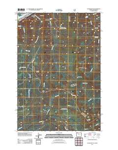
2011 Map of Tanner Butte
USGS Topo · Published 2011About this map
Tanner Butte and the surrounding high peaks of the Cascade Range dominate this 2011 survey, where the landscape is defined by its dramatic verticality and drainage systems. Flowing through the northern boundary, the Columbia River creates the Hamilton Island Reach near Ives Island. The map is particularly notable for its concentration of named waterfalls, including Wahclella Falls, Elowah Falls, and Punch Bowl Falls, which highlight the steep descent of tributaries toward the river. To the south, the headwaters of the Bull Run River and its feeder, Falls Creek, underscore the area's role as a vital watershed. Access through this terrain is limited to specialized routes like Talapus Ridge Rd and the Moffatt Way Trl, reflecting the primitive state of the interior topography between Eagle Butte and Table Mountain.
Find a feature on this map
32 named features on this map. Tap any name to fly to it.
Don’t see what you’re looking for? This feature index may not catch every label — zoom into the map to look around manually.
Map Details
Editions of this 2011 Tanner Butte Map
This is the sole edition of this map. No revisions or reprints were ever made.
Other maps of this area

1916 · Estacada
USGS Topo · 1:125,000

1924 · Mount Hood
USGS Topo · 1:125,000

1926 · Hood River
USGS Topo · 1:125,000

1927 · Mount Hood
USGS Topo · 1:125,000

1929 · Hood River
USGS Topo · 1:125,000

1948 · Vancouver
USGS Topo · 1:250,000

1950 · Vancouver
USGS Topo · 1:250,000

1950 · Vancouver
USGS Topo · 1:250,000

1953 · The Dalles
USGS Topo · 1:250,000

1954 · Bridal Veil
USGS Topo · 1:62,500