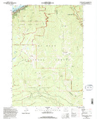
1994 Map of Tanner Butte
USGS Topo · Published 1996About this map
Columbia River Gorge National Scenic Area dominates the northern landscape of this survey, where the Columbia River forms the border between Oregon and Washington. The terrain is defined by dramatic elevation changes and a dense network of water features, including Punch Bowl Falls, Tish Falls, and Wahe Falls. Protected lands are central to this area's character, with the Bull Run Watershed Management Unit and Columbia Wilderness preserving the watershed of the Bull Run River. High points like Tanner Butte and Mt Talapus overlook a series of alpine water bodies such as Dublin Lake and Tanner Lake. Along the riverbank, John B Yeon State Park sits near Ives Island, marking a narrow corridor of infrastructure where Highway 30 and Interstate 84 follow the historic river route.
Find a feature on this map
44 named features on this map. Tap any name to fly to it.
Don’t see what you’re looking for? This feature index may not catch every label — zoom into the map to look around manually.
Map Details
Editions of this 1994 Tanner Butte Map
This is the sole edition of this map. No revisions or reprints were ever made.
Other maps of this area

1916 · Estacada
USGS Topo · 1:125,000

1924 · Mount Hood
USGS Topo · 1:125,000

1926 · Hood River
USGS Topo · 1:125,000

1927 · Mount Hood
USGS Topo · 1:125,000

1929 · Hood River
USGS Topo · 1:125,000

1948 · Vancouver
USGS Topo · 1:250,000

1950 · Vancouver
USGS Topo · 1:250,000

1950 · Vancouver
USGS Topo · 1:250,000

1953 · The Dalles
USGS Topo · 1:250,000

1954 · Bridal Veil
USGS Topo · 1:62,500