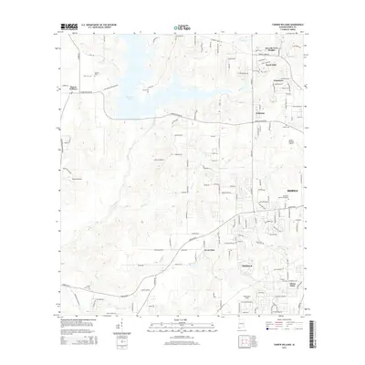
2014 Map of Tanner Williams
USGS Topo · Published 2014About this map
Big Creek Lake dominates the upper-left landscape, a vital water source fed by Big Creek and Big Cr in this portion of western Mobile County. The map details a transition from the semi-rural outskirts near the Mississippi border toward the growing western suburbs of Mobile. Significant aviation infrastructure is present with both the Mobile Regional Airport and Richardson Field, alongside smaller facilities like Skywest Airpark. Family history is deeply rooted in this area, evidenced by a high density of small burial grounds including Dees Cem, Williams Cem, Tanner Cem, and Shady Grove Cem. The settlement pattern follows a network of historic roads such as Tanner Williams Rd and Howells Ferry Rd, which connect established communities like Tanner Williams and Seven Hills to newer residential developments such as Scenic Hills and Ponderosa.
Find a feature on this map
149 named features on this map. Tap any name to fly to it.
Don’t see what you’re looking for? This feature index may not catch every label — zoom into the map to look around manually.
Map Details
Editions of this 2014 Tanner Williams Map
This is the sole edition of this map. No revisions or reprints were ever made.
Other maps of this area

1922 · Mobile
USGS Topo · 1:62,500

1940 · Mobile
USGS Topo · 1:62,500

1941 · Hurley
USGS Topo · 1:62,500

1941 · Creola
USGS Topo · 1:62,500

1942 · Kushla
USGS Topo · 1:31,680

1942 · Theodore
USGS Topo · 1:31,680

1942 · Wilmer
USGS Topo · 1:62,500

1943 · Theodore
USGS Topo · 1:31,680

1943 · Creola
USGS Topo · 1:62,500

1943 · Hurley
USGS Topo · 1:62,500