
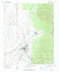
1964 Map of Taos
USGS Topo · Published 1966About this map
Taos Pueblo and the village of Taos serve as the focal points for this 1960s study of the high desert and mountain interface. The landscape is defined by its deep Spanish and Indigenous heritage, evidenced by the intricate system of irrigation ditches such as the Acequia Madre, Acequia de la Loma, and Acequia del Monte that draw from the Rio Pueblo de Taos. These communal water systems reflect a centuries-old agricultural tradition still vibrant at the time of the survey.
Find a feature on this map
46 named features on this map. Tap any name to fly to it.
Don’t see what you’re looking for? This feature index may not catch every label — zoom into the map to look around manually.
Map Details
Editions of this 1964 Taos Map
2 editions found
Other maps of this area

1954 · Raton
USGS Topo · 1:250,000

1958 · Raton
USGS Topo · 1:250,000

1963 · Wheeler Peak
USGS Topo · 1:24,000

1963 · Arroyo Seco
USGS Topo · 1:24,000

1963 · Arroyo Hondo
USGS Topo · 1:24,000

1964 · Los Cordovas
USGS Topo · 1:24,000

1964 · Ranchos De Taos
USGS Topo · 1:24,000

1964 · Taos SW
USGS Topo · 1:24,000

1965 · Pueblo Peak
USGS Topo · 1:24,000

1965 · Shady Brook
USGS Topo · 1:24,000