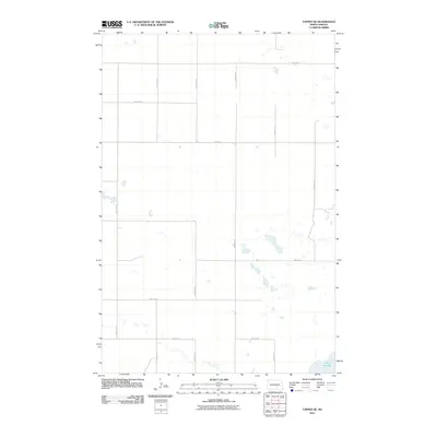
2011 Map of Tappen SE
USGS Topo · Published 2011About this map
Lake George anchors the southeastern corner of this Kidder County landscape, surrounded by the characteristic prairie pothole topography of the region. The map reveals a strictly organized section-line road network that defines the rural character of this area in the early 21st century. Key thoroughfares such as 43rd Ave SE and 45th St Se segment the terrain into precise agricultural blocks, illustrating the enduring influence of the Public Land Survey System on North Dakota's rural development. The scattered wetlands and seasonal basins visible throughout the grid highlight the natural drainage patterns of the plains, where water bodies often collect at the intersection of local routes like 40th St Se and 44th Ave SE.
Find a feature on this map
13 named features on this map. Tap any name to fly to it.
Don’t see what you’re looking for? This feature index may not catch every label — zoom into the map to look around manually.
Map Details
Editions of this 2011 Tappen SE Map
This is the sole edition of this map. No revisions or reprints were ever made.
Other maps of this area

1952 · Tappen South
USGS Topo · 1:24,000

1952 · Tappen SE
USGS Topo · 1:24,000

1952 · Tappen NE
USGS Topo · 1:24,000

1952 · Tappen North
USGS Topo · 1:24,000

1953 · Jamestown
USGS Topo · 1:250,000

1955 · Crystal Springs
USGS Topo · 1:24,000

1955 · Medina SW
USGS Topo · 1:24,000

1956 · Jamestown
USGS Topo · 1:250,000
1975 · Tappen North
USGS Topo · 1:24,000

1975 · Medina SW
USGS Topo · 1:24,000