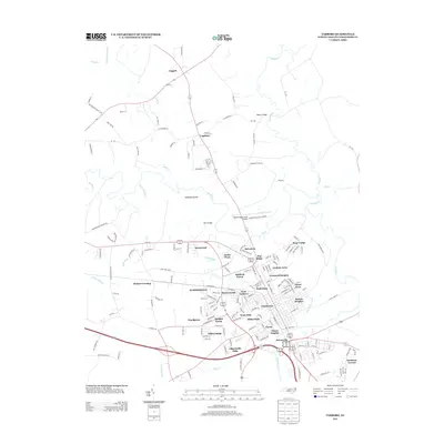
2013 Map of Tarboro
USGS Topo · Published 2013About this map
Princeville and its surroundings on the south bank of the Tar River anchor the southern portion of this landscape, situated just across the water from the heart of Tarboro. The map illustrates a dense collection of residential developments and established neighborhoods including Glenburnie, Runnymeade, and Hilma Park, which together show the expansion of the community westward and northward from the river's bend. To the north, the terrain transitions into a more rural pattern of dispersed settlements such as Leggett and Logsboro, defined by the winding paths of Fishing Cr and Swift Cr. The presence of the Tarboro-Edgecombe Airport and the complex network of local roads like Battleboro Leggett Rd reveal the modern transportation infrastructure that connects these rural agricultural areas to the town's urban core.
Find a feature on this map
167 named features on this map. Tap any name to fly to it.
Don’t see what you’re looking for? This feature index may not catch every label — zoom into the map to look around manually.
Map Details
Editions of this 2013 Tarboro Map
This is the sole edition of this map. No revisions or reprints were ever made.
Other maps of this area

1901 · Parmele
USGS Topo · 1:62,500

1902 · Parmele
USGS Topo · 1:62,500

1902 · Tarboro
USGS Topo · 1:62,500

1903 · Tarboro
USGS Topo · 1:62,500

1953 · Norfolk
USGS Topo · 1:250,000

1953 · Rocky Mount
USGS Topo · 1:250,000

1954 · Rocky Mount
USGS Topo · 1:250,000

1960 · Draughn
USGS Topo · 1:24,000

1961 · Whitakers
USGS Topo · 1:24,000

1962 · Hobgood
USGS Topo · 1:24,000