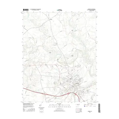
2016 Map of Tarboro
USGS Topo · Published 2016About this map
Princeville, the oldest town incorporated by African Americans in the United States, sits prominently on the south bank of the Tar River. This landscape is defined by the winding paths of the river and Fishing Creek, which converge amidst low-lying areas like Hemmed Island and Hatcher Swamp. The town of Tarboro serves as the central hub, showing a dense street grid that includes landmarks such as the Calvary Episcopal Churchyard and Old Town Cem. To the south, Edgecombe Community Coll and the community of Farrar mark the transition toward more rural stretches. Agricultural patterns are evident in the surrounding countryside, connected by historic crossings like Bells Bridge and Mabrey Bridge, and served by the Tarboro-Edgecombe Airport. The map details numerous smaller drainage systems, including Harts Mill Run and Holly Cr, which have historically influenced local land use and settlement boundaries in this coastal plain region.
Find a feature on this map
134 named features on this map. Tap any name to fly to it.
Don’t see what you’re looking for? This feature index may not catch every label — zoom into the map to look around manually.
Map Details
Editions of this 2016 Tarboro Map
This is the sole edition of this map. No revisions or reprints were ever made.
Other maps of this area

1901 · Parmele
USGS Topo · 1:62,500

1902 · Parmele
USGS Topo · 1:62,500

1902 · Tarboro
USGS Topo · 1:62,500

1903 · Tarboro
USGS Topo · 1:62,500

1953 · Norfolk
USGS Topo · 1:250,000

1953 · Rocky Mount
USGS Topo · 1:250,000

1954 · Rocky Mount
USGS Topo · 1:250,000

1960 · Draughn
USGS Topo · 1:24,000

1961 · Whitakers
USGS Topo · 1:24,000

1962 · Hobgood
USGS Topo · 1:24,000