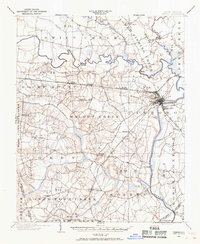
1902 Map of Tarboro
USGS Topo · Published 1968About this map
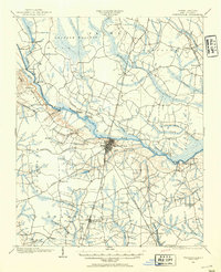
Tarboro and West Tarboro serve as the hub of this Edgecombe County landscape at the start of the twentieth century, where the Tar River meets a bustling network of commerce and transit. The river still actively supported a Steamboat Route, which navigated past Suggs Landing and Old Sparta. Meanwhile, the Atlantic Coast Line railroad bisected the territory, connecting rural outposts like Kingsboro and Medora to the county seat.
Find a feature on this map
78 named features on this map. Tap any name to fly to it.
Don’t see what you’re looking for? This feature index may not catch every label — zoom into the map to look around manually.
Map Details
Editions of this 1902 Tarboro Map
This is the sole edition of this map. No revisions or reprints were ever made.
Other maps of this area
1901 · Parmele
USGS Topo · 1:62,500
1902 · Parmele
USGS Topo · 1:62,500

1902 · Rocky Mount
USGS Topo · 1:62,500
1903 · Tarboro
USGS Topo · 1:62,500
1903 · Winterville
USGS Topo · 1:62,500
1904 · Falkland
USGS Topo · 1:62,500

1904 · Rocky Mount
USGS Topo · 1:62,500
1904 · Wilson
USGS Topo · 1:62,500
1905 · Winterville
USGS Topo · 1:62,500

1953 · Norfolk
USGS Topo · 1:250,000