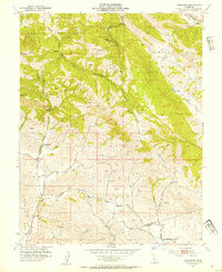
1953 Map of Tassajara
USGS Topo · Published 1954About this map
Morgan Territory and the Black Hills dominate this mid-century topographic study of the divide between Contra Costa and Alameda counties. The landscape is defined by its canyon systems and historic land grants, notably the Las Positas Grant Boundary and the expansive Cañada de los Vaqueros. At this time, the rural character of the region was preserved through a network of winding roads like Morgan Territory Road and Finley Road, connecting isolated springs and small agricultural outposts.
Find a feature on this map
29 named features on this map. Tap any name to fly to it.
Don’t see what you’re looking for? This feature index may not catch every label — zoom into the map to look around manually.
Map Details
Editions of this 1953 Tassajara Map
4 editions found
Other maps of this area

1896 · Mt. Diablo
USGS Topo · 1:62,500

1898 · Mt. Diablo
USGS Topo · 1:62,500

1906 · Pleasanton
USGS Topo · 1:62,500

1907 · Tesla
USGS Topo · 1:62,500

1911 · Byron Hot Springs
USGS Topo · 1:31,680

1914 · Brentwood
USGS Topo · 1:31,680

1916 · Lone Tree Valley
USGS Topo · 1:31,680

1916 · Byron Hot Springs
USGS Topo · 1:31,680

1916 · Byron
USGS Topo · 1:62,500

1940 · Byron
USGS Topo · 1:62,500