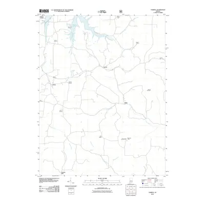
2010 Map of Taswell
USGS Topo · Published 2010About this map
Patoka Lake dominates the northern landscape of this Crawford County region, where the reservoir's fingers reach into valleys carved by the Little Patoka River and Highfill Creek. This 2010 survey reveals a rural landscape defined by scattered settlements like Taswell, Eckerty, and Mifflin, alongside numerous family-named burial grounds including Mount Eden Cemetery and Williams Cemetery. The area’s rugged natural profile is anchored by Tick Ridge and the Hemlock Cliffs Recreation Area, a site of notable geological interest. A distinct shift in the watershed is evident as the terrain transitions toward the Anderson River and Otter Creek systems. Historical infrastructure such as Spears Lookout Tower and the Salinda Lake Dam remain visible, while the southern edge is marked by the community of Doolittle Mills. This map illustrates the intersection of mid-century water management projects with nineteenth-century rural settlement patterns.
Find a feature on this map
32 named features on this map. Tap any name to fly to it.
Don’t see what you’re looking for? This feature index may not catch every label — zoom into the map to look around manually.
Map Details
Editions of this 2010 Taswell Map
This is the sole edition of this map. No revisions or reprints were ever made.
Other maps of this area

1950 · Beechwood
USGS Topo · 1:24,000

1950 · Valeene
USGS Topo · 1:24,000

1950 · English
USGS Topo · 1:24,000

1950 · Alton
USGS Topo · 1:62,500

1956 · Greenbrier
USGS Topo · 1:24,000

1956 · Taswell
USGS Topo · 1:24,000

1956 · Vincennes
USGS Topo · 1:250,000

1957 · Vincennes
USGS Topo · 1:250,000

1957 · Cuzco
USGS Topo · 1:24,000

1957 · Birdseye
USGS Topo · 1:24,000