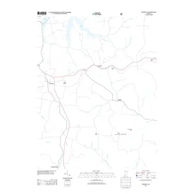
2013 Map of Taswell
USGS Topo · Published 2013About this map
Taswell and Eckerty anchor the center of this southern Indiana landscape, which is defined by a dense network of watercourses and topographical landmarks. The northern reaches are dominated by the waters of Patoka Lake and the winding course of the Little Patoka River. Further south, the terrain becomes more distinct with features like Tick Ridge and Golden Hollow, alongside the specialized natural geography of the Hemlock Cliffs Recreation Area. This area is notable for its geological markers, including Ravine Arch, Arrowhead Arch, and the prominent Tunnel Hill near the eastern boundary. Small communities such as Mifflin and Doolittle Mills appear along the southern creek beds, including Otter Cr and the Middle Fork Anderson River, illustrating a settlement pattern deeply tied to the local drainage basins and the challenging relief of Crawford County.
Find a feature on this map
25 named features on this map. Tap any name to fly to it.
Don’t see what you’re looking for? This feature index may not catch every label — zoom into the map to look around manually.
Map Details
Editions of this 2013 Taswell Map
This is the sole edition of this map. No revisions or reprints were ever made.
Other maps of this area

1950 · Beechwood
USGS Topo · 1:24,000

1950 · Valeene
USGS Topo · 1:24,000

1950 · English
USGS Topo · 1:24,000

1950 · Alton
USGS Topo · 1:62,500

1956 · Greenbrier
USGS Topo · 1:24,000

1956 · Taswell
USGS Topo · 1:24,000

1956 · Vincennes
USGS Topo · 1:250,000

1957 · Vincennes
USGS Topo · 1:250,000

1957 · Cuzco
USGS Topo · 1:24,000

1957 · Birdseye
USGS Topo · 1:24,000