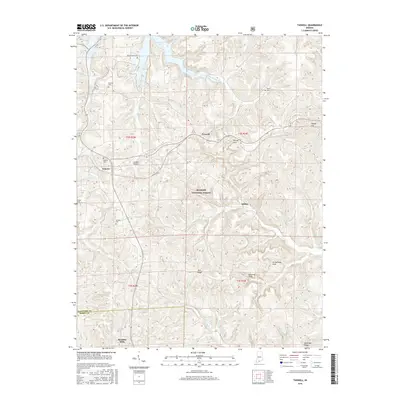
2016 Map of Taswell
USGS Topo · Published 2016About this map
The Hoosier National Forest dominates this section of southern Indiana, where the rugged terrain of the Crawford Upland is deeply dissected by a network of creeks and rivers. Small rural settlements like Taswell and Eckerty sit along the east-west corridor, while Doolittle Mills marks the southern reach near the boundary of Crawford Co Perry Co. The landscape is characterized by prominent ridges such as Tick Ridge and McKensie Ridge, alongside unique geological features like Ravine Arch and Arrowhead Arch.
Find a feature on this map
36 named features on this map. Tap any name to fly to it.
Don’t see what you’re looking for? This feature index may not catch every label — zoom into the map to look around manually.
Map Details
Editions of this 2016 Taswell Map
This is the sole edition of this map. No revisions or reprints were ever made.
Other maps of this area

1950 · Beechwood
USGS Topo · 1:24,000

1950 · Valeene
USGS Topo · 1:24,000

1950 · English
USGS Topo · 1:24,000

1950 · Alton
USGS Topo · 1:62,500

1956 · Greenbrier
USGS Topo · 1:24,000

1956 · Taswell
USGS Topo · 1:24,000

1956 · Vincennes
USGS Topo · 1:250,000

1957 · Vincennes
USGS Topo · 1:250,000

1957 · Cuzco
USGS Topo · 1:24,000

1957 · Birdseye
USGS Topo · 1:24,000