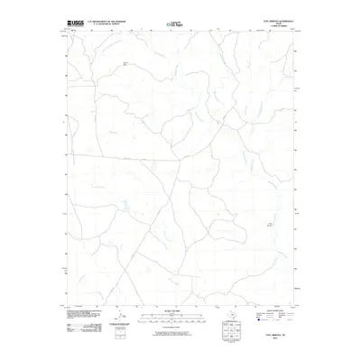
2010 Map of Tate Arroyo
USGS Topo · Published 2010About this map
Tate Arroyo and the broad expanse of Payne Flat characterize this portion of Armstrong County, defined by a complex network of seasonal watercourses. The drainage pattern is led by Mulberry Creek, which draws in numerous tributaries including Boggy Creek, Halls Creek, and the aptly named Troublesome Creek. This 2010 survey reflects a landscape largely dedicated to ranching and open range, where human presence is marked primarily by a sparse grid of rural routes such as Uniform Rd, Co Rd Z, and Co Rd X. The convergence of Lone Tree Creek and Battle Creek in the southwest further illustrates the dissected terrain typical of the Texas Panhandle's canyon-rim country, providing a detailed look at the hydrology of the region before these waters reach the lower plains.
Find a feature on this map
15 named features on this map. Tap any name to fly to it.
Don’t see what you’re looking for? This feature index may not catch every label — zoom into the map to look around manually.
Map Details
Editions of this 2010 Tate Arroyo Map
This is the sole edition of this map. No revisions or reprints were ever made.
Other maps of this area

1954 · Plainview
USGS Topo · 1:250,000

1958 · Plainview
USGS Topo · 1:250,000

1960 · Indian Peak
USGS Topo · 1:62,500

1960 · Brice
USGS Topo · 1:62,500

1963 · Blue Hole Springs
USGS Topo · 1:24,000

1963 · Clarendon
USGS Topo · 1:24,000

1963 · Buffalo Arroyo
USGS Topo · 1:24,000

1963 · Paloduro
USGS Topo · 1:24,000

1963 · Tate Arroyo
USGS Topo · 1:24,000

1963 · Clarendon SW
USGS Topo · 1:24,000