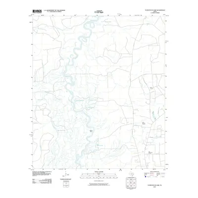
2010 Map of Tater Patch Lake
USGS Topo · Published 2010About this map
The Neches River carves a winding path through this corner of Hardin County, creating a complex network of oxbows and bottomland water bodies including Horseshoe Lake, Jackson Lake, and Tater Patch Lake. The eastern uplands are defined by family-named landmarks and rural infrastructure, most notably Withers Cemetery and the industrial activity at the Sally Withers Lake Oil Field. A transition from the river lowlands to higher ground is marked by Yellow Bluff and the Cairo Springs Lookout, which provides a vantage point over the dense drainage system of Black Branch and Turner Branch. Local roads such as Withers Cemetary Rd and Weiss Bluff Rd connect these remote landmarks, illustrating the enduring influence of early settler families on the modern landscape of Southeast Texas.
Find a feature on this map
28 named features on this map. Tap any name to fly to it.
Don’t see what you’re looking for? This feature index may not catch every label — zoom into the map to look around manually.
Map Details
Editions of this 2010 Tater Patch Lake Map
This is the sole edition of this map. No revisions or reprints were ever made.
Other maps of this area

1952 · Lake Charles
USGS Topo · 1:250,000

1954 · Lake Charles
USGS Topo · 1:250,000

1954 · Beaumont
USGS Topo · 1:250,000

1955 · Silsbee
USGS Topo · 1:62,500

1955 · Bessmay
USGS Topo · 1:62,500

1957 · Beaumont
USGS Topo · 1:250,000

1958 · Spurger
USGS Topo · 1:62,500

1958 · Kirbyville
USGS Topo · 1:62,500

1984 · Beaumont
USGS Topo · 1:250,000

1984 · Potato Patch Lake
USGS Topo · 1:24,000