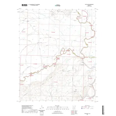
2020 Map of Tates Bluff
USGS Topo · Published 2020About this map
Tates Bluff stands at the confluence where the Little Missouri River joins the Ouachita River, marking a historically significant riverine junction in this part of Arkansas. The landscape is defined by the winding paths of these waterways and their tributaries, including Terre Noire Creek and French Creek, which carve through the terrain. For genealogists, the map is remarkably detailed with family-linked landmarks and rural burial sites, such as Vaden Cem, Easley Cem, and the Hill Cem near the Rocky Hill area.
Find a feature on this map
69 named features on this map. Tap any name to fly to it.
Don’t see what you’re looking for? This feature index may not catch every label — zoom into the map to look around manually.
Map Details
Editions of this 2020 Tates Bluff Map
This is the sole edition of this map. No revisions or reprints were ever made.
Other maps of this area

1901 · Gurdon
USGS Topo · 1:125,000

1903 · Camden
USGS Topo · 1:125,000

1953 · El Dorado
USGS Topo · 1:250,000

1957 · El Dorado
USGS Topo · 1:250,000

1958 · El Dorado
USGS Topo · 1:250,000

1960 · El Dorado
USGS Topo · 1:250,000

1970 · Reader
USGS Topo · 1:24,000
1970 · Curtis
USGS Topo · 1:24,000

1971 · Tates Bluff
USGS Topo · 1:24,000
1971 · Sparkman
USGS Topo · 1:24,000