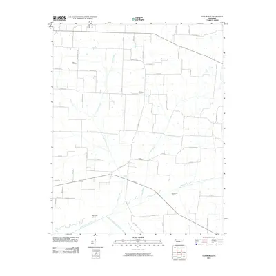
2010 Map of Tatumville
USGS Topo · Published 2010About this map
Tatumville Bottom and Macedonia Bottom define the low-lying southern reach of this landscape, where the North Fork Forked Deer River and Middle Fork Forked Deer River converge. This 2010 survey illustrates a rural West Tennessee topography characterized by a dense network of country roads named for local families, including Adkins Cemetery Rd, Bobby Thompson Rd, and Joe Pope Rd. Several burial grounds are preserved across the quadrangle, notably Atkins Cemetery in the northwest and Shaw Cemetery near the center, providing essential points of reference for genealogical researchers. Smaller tributaries like Doakville Creek, Harris Creek, and Bethel Branch drain the agricultural plots, threading between long-established property boundaries and junctions like Bakers Loop.
Find a feature on this map
64 named features on this map. Tap any name to fly to it.
Don’t see what you’re looking for? This feature index may not catch every label — zoom into the map to look around manually.
Map Details
Editions of this 2010 Tatumville Map
This is the sole edition of this map. No revisions or reprints were ever made.
Other maps of this area

1939 · Dyersburg
USGS Topo · 1:62,500

1939 · Halls
USGS Topo · 1:62,500

1952 · Bonicord
USGS Topo · 1:24,000

1952 · Newbern
USGS Topo · 1:24,000

1952 · Lane
USGS Topo · 1:24,000

1956 · Dyersburg
USGS Topo · 1:250,000

1956 · Blytheville
USGS Topo · 1:250,000

1959 · Blytheville
USGS Topo · 1:250,000

1961 · Halls
USGS Topo · 1:62,500
1961 · Dyersburg
USGS Topo · 1:62,500