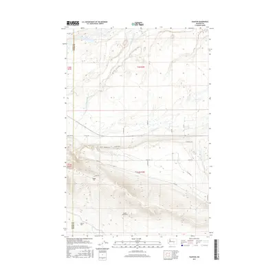
2017 Map of Taunton
USGS Topo · Published 2017About this map
Saddle Mountains dominate the southern landscape of this central Washington survey, creating a dramatic elevation shift that drops away into the Wahluke Slope. The corridor between these heights and the northern flats is defined by the winding course of Lower Crab Creek, which supports a network of wetlands and small water bodies like Royal Lake. The terrain transitions from the high, ridged crest of the mountains through Saddle Gap down to the low-lying basin where the creek flows.
Find a feature on this map
25 named features on this map. Tap any name to fly to it.
Don’t see what you’re looking for? This feature index may not catch every label — zoom into the map to look around manually.
Map Details
Editions of this 2017 Taunton Map
This is the sole edition of this map. No revisions or reprints were ever made.
Other maps of this area
1923 · Corfu
USGS Topo · 1:62,500
1924 · Othello
USGS Topo · 1:62,500
1924 · Hanford
USGS Topo · 1:62,500
1925 · Scooteney Lake
USGS Topo · 1:62,500
1951 · Scooteney Lake
USGS Topo · 1:62,500
1951 · Corfu
USGS Topo · 1:62,500
1951 · Hanford
USGS Topo · 1:62,500
1953 · Walla Walla
USGS Topo · 1:250,000
1954 · Soda Lake
USGS Topo · 1:24,000
1954 · Othello
USGS Topo · 1:24,000