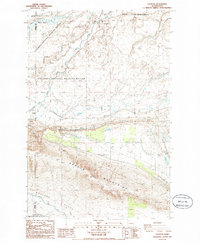
1986 Map of Taunton
USGS Topo · Published 1986About this map
Saddle Mountains dominate the southern portion of this landscape, rising sharply above the Wahluke Slope and the highly engineered water systems of the Columbia Basin. The map details the infrastructure of mid-century irrigation and energy, featuring the Wahluke Branch Canal, an aqueduct, and a siphon that facilitate agricultural movement across the arid terrain. Central to the local history is the railroad settlement of Taunton, positioned alongside the Milwaukee Road and its associated Taunton Substation. The northern reaches are characterized by the complex wetland systems of the Columbia National Wildlife Refuge, where Crab Creek and Royal Lake provide a stark contrast to the nearby Hanford Site (DOE) boundary. This 1980s survey captures a territory split between intensive conservation efforts and significant federal industrial footprints.
Find a feature on this map
22 named features on this map. Tap any name to fly to it.
Don’t see what you’re looking for? This feature index may not catch every label — zoom into the map to look around manually.
Map Details
Editions of this 1986 Taunton Map
This is the sole edition of this map. No revisions or reprints were ever made.
Other maps of this area

1923 · Corfu
USGS Topo · 1:62,500

1924 · Othello
USGS Topo · 1:62,500

1924 · Hanford
USGS Topo · 1:62,500

1925 · Scooteney Lake
USGS Topo · 1:62,500

1951 · Scooteney Lake
USGS Topo · 1:62,500

1951 · Corfu
USGS Topo · 1:62,500

1951 · Hanford
USGS Topo · 1:62,500

1953 · Walla Walla
USGS Topo · 1:250,000

1954 · Soda Lake
USGS Topo · 1:24,000

1954 · Othello
USGS Topo · 1:24,000