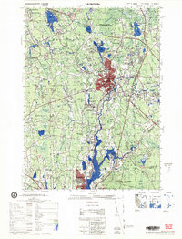
1979 Map of Taunton
USGS Topo · Published 1979About this map
The Taunton River serves as the central artery for this 1979 survey of Bristol County, flowing through a landscape defined by significant institutional footprints and a dense network of water bodies. The city of Taunton appears as a major hub, bounded by the Taunton State Hospital and the sprawling Dever State School. The map captures a transitional era for local transportation and industry, with Conrail lines intersecting established neighborhoods like Barrowsville and Chartley, while the Raynham Racetrack stands out in the north.
Find a feature on this map
107 named features on this map. Tap any name to fly to it.
Don’t see what you’re looking for? This feature index may not catch every label — zoom into the map to look around manually.
Map Details
Editions of this 1979 Taunton Map
This is the sole edition of this map. No revisions or reprints were ever made.
Other maps of this area

1885 · New Bedford
USGS Topo · 1:62,500

1885 · Abington
USGS Topo · 1:62,500

1885 · Middleboro
USGS Topo · 1:62,500

1885 · Taunton
USGS Topo · 1:62,500

1886 · Dedham
USGS Topo · 1:62,500

1887 · Franklin
USGS Topo · 1:62,500

1887 · Providence
USGS Topo · 1:62,500

1888 · New Bedford
USGS Topo · 1:62,500

1888 · Fall River
USGS Topo · 1:62,500

1888 · Taunton
USGS Topo · 1:62,500