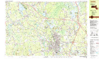
1987 Map of Taunton
USGS Topo · Published 1987About this map
Taunton and its surrounding villages in Bristol County appear at a moment of modern growth and institutional significance in the late 1980s. The city's northern edge is dominated by Lake Sabbatia and the industrial corridors of the Conrail and Amtrak lines, while the established campus of Wheaton College anchors the town of Norton. To the east, the sprawling Hockomock Swamp Wildlife Management Area provides a stark contrast to the concentrated urban core of Whittenton and Weir Village.
Find a feature on this map
84 named features on this map. Tap any name to fly to it.
Don’t see what you’re looking for? This feature index may not catch every label — zoom into the map to look around manually.
Map Details
Editions of this 1987 Taunton Map
2 editions found
Other maps of this area

1885 · Abington
USGS Topo · 1:62,500

1885 · Middleboro
USGS Topo · 1:62,500

1885 · Taunton
USGS Topo · 1:62,500

1886 · Dedham
USGS Topo · 1:62,500

1887 · Franklin
USGS Topo · 1:62,500

1887 · Providence
USGS Topo · 1:62,500

1888 · Taunton
USGS Topo · 1:62,500

1888 · Middleboro
USGS Topo · 1:62,500

1888 · Abington
USGS Topo · 1:62,500

1889 · Providence
USGS Topo · 1:62,500