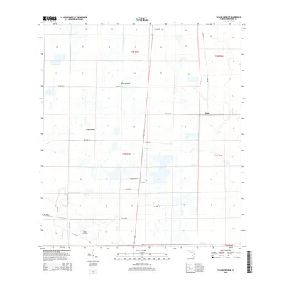
2015 Map of Taylor Creek NE
USGS Topo · Published 2015About this map
White Hammock and the distinct terrain of Eagle Island anchor this interior section of Okeechobee County. The landscape is defined by the headwaters and drainage patterns of Taylor Cr and Gomez Cr, which cut through a grid of rural routes. The presence of McArthur Dairy Rd and McArthur Barn Rd points to the area's agricultural and dairy heritage, highlighting the specific land use in this part of Florida during the early 21st century. Settlement is concentrated at small hubs like Hilolo, while much of the terrain remains divided into large sections such as t34s r35e and t35s r35e, reflecting the enduring structure of the Public Land Survey System in managing this expanse of hammock and creek land.
Find a feature on this map
30 named features on this map. Tap any name to fly to it.
Don’t see what you’re looking for? This feature index may not catch every label — zoom into the map to look around manually.
Map Details
Editions of this 2015 Taylor Creek NE Map
This is the sole edition of this map. No revisions or reprints were ever made.
Other maps of this area

1953 · Taylor Creek NW
USGS Topo · 1:24,000

1953 · Fort Drum
USGS Topo · 1:24,000

1953 · Fort Drum SW
USGS Topo · 1:24,000

1953 · Fellsmere 4 SW
USGS Topo · 1:24,000

1953 · Taylor Creek SW
USGS Topo · 1:24,000

1953 · Okeechobee 1 SW
USGS Topo · 1:24,000

1953 · Taylor Creek SE
USGS Topo · 1:24,000

1953 · Taylor Creek NE
USGS Topo · 1:24,000

1953 · Okeechobee 1 NW
USGS Topo · 1:24,000

1956 · Fort Pierce
USGS Topo · 1:250,000