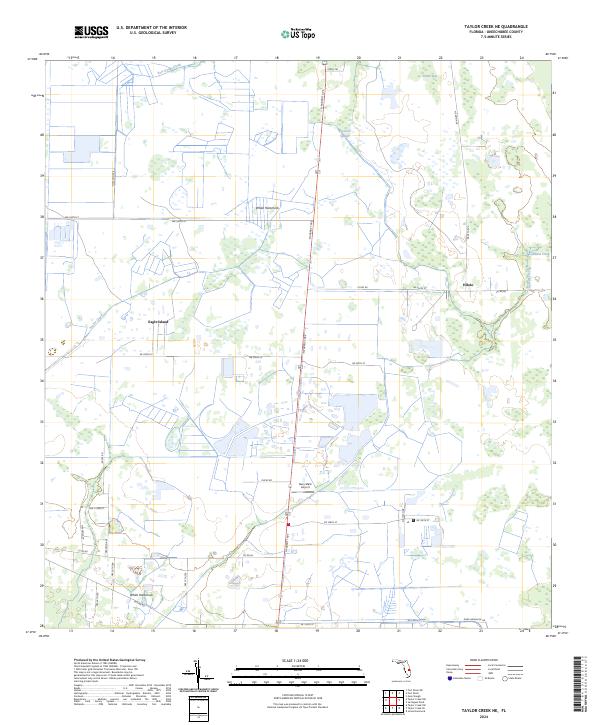
2024 Map of Taylor Creek NE
USGS Topo · Published 2024About this map
White Hammock and Hilolo anchor this interior Florida landscape, where the flatlands of Okeechobee County meet an intricate system of sloughs and creeks. The drainage patterns are defined by the winding course of Fort Drum Creek to the north and the convergence of Cowbone Creek and Gomez Creek in the east. Notable for its aviation and agricultural heritage, the area includes the Gary Stark Airport situated along N Parrott Ave, providing a vital link for this rural corridor. This modern survey reflects a landscape divided by section lines and an extensive network of local roads such as Co Rd 68 and Rucks Rd, which weave around natural landmarks like Eagle Island and the wetlands of Joe Gore Slough. The persistence of these named hammocks and islands offers a window into the traditional cattle and citrus land use that has historically characterized this part of the Florida peninsula.
Find a feature on this map
39 named features on this map. Tap any name to fly to it.
Don’t see what you’re looking for? This feature index may not catch every label — zoom into the map to look around manually.
Map Details
Editions of this 2024 Taylor Creek NE Map
This is the sole edition of this map. No revisions or reprints were ever made.
Other maps of this area

1953 · Taylor Creek NW
USGS Topo · 1:24,000

1953 · Fort Drum
USGS Topo · 1:24,000

1953 · Fort Drum SW
USGS Topo · 1:24,000

1953 · Fellsmere 4 SW
USGS Topo · 1:24,000

1953 · Taylor Creek SW
USGS Topo · 1:24,000

1953 · Okeechobee 1 SW
USGS Topo · 1:24,000

1953 · Taylor Creek SE
USGS Topo · 1:24,000

1953 · Taylor Creek NE
USGS Topo · 1:24,000

1953 · Okeechobee 1 NW
USGS Topo · 1:24,000

1956 · Fort Pierce
USGS Topo · 1:250,000