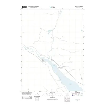
2011 Map of Taylor NE
USGS Topo · Published 2011About this map
The Calamus Reservoir dominates the southeastern portion of this Loup County landscape, where the Calamus River meets the smaller tributary of Gracie Creek. The map documents a sparsely populated ranching region defined by large family holdings such as Chapman Ranch, Schonhar Ranch, and Conner Ranch. Water management is central to the area's geography, visible through features like Morgan Dam and its associated Morgan Reservoir Number 1 in the north. This 2011 survey captures the area's role as a recreational destination, with established sites like Hannaman Bayou Campground and Valleyview Flat Campground situated along the reservoir's northern shore. The terrain is largely defined by the drainage patterns toward the main reservoir, with local roads like Calamus Dam Rd providing access across this Nebraska Sandhills environment.
Find a feature on this map
16 named features on this map. Tap any name to fly to it.
Don’t see what you’re looking for? This feature index may not catch every label — zoom into the map to look around manually.
Map Details
Editions of this 2011 Taylor NE Map
This is the sole edition of this map. No revisions or reprints were ever made.
Other maps of this area

1952 · Burwell
USGS Topo · 1:24,000

1952 · Taylor NW
USGS Topo · 1:24,000

1952 · Taylor SE
USGS Topo · 1:24,000

1952 · Taylor
USGS Topo · 1:24,000

1952 · Burwell NW
USGS Topo · 1:24,000

1952 · Taylor NE
USGS Topo · 1:24,000

1955 · Broken Bow
USGS Topo · 1:250,000

1955 · O'Neill
USGS Topo · 1:250,000

1956 · Broken Bow
USGS Topo · 1:250,000

1959 · O'Neill
USGS Topo · 1:250,000