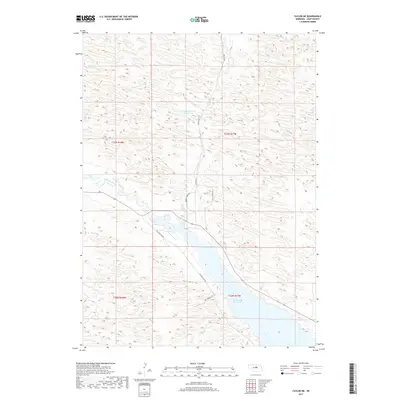
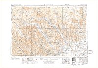
2017 Map of Taylor NE
USGS Topo · Published 2017About this map
Calamus Reservoir dominates the southern landscape of this Loup County quadrangle, where the engineering of the Calamus Dam Rd manages the waters of the Calamus River. The terrain is defined by the unique topography of the Nebraska Sandhills, characterized by countless stabilized dunes and depressions that create a complex network of ephemeral and permanent water bodies. Small-scale water management is evident at Morgan Reservoir Number 1 and Bald Lake, while drainage is channeled through Gracie Cr. A sparse grid of rural corridors, including Gracie Creek Ave and Valley View Ave, provides access to this ranching country. The map illustrates the contemporary intersection of recreational water use and traditional prairie land management in the early twenty-first century.
Find a feature on this map
14 named features on this map. Tap any name to fly to it.
Don’t see what you’re looking for? This feature index may not catch every label — zoom into the map to look around manually.
Map Details
Editions of this 2017 Taylor NE Map
This is the sole edition of this map. No revisions or reprints were ever made.
Other maps of this area
1952 · Burwell
USGS Topo · 1:24,000
1952 · Taylor NW
USGS Topo · 1:24,000
1952 · Taylor SE
USGS Topo · 1:24,000
1952 · Taylor
USGS Topo · 1:24,000
1952 · Burwell NW
USGS Topo · 1:24,000
1952 · Taylor NE
USGS Topo · 1:24,000
1955 · Broken Bow
USGS Topo · 1:250,000

1955 · O'Neill
USGS Topo · 1:250,000
1956 · Broken Bow
USGS Topo · 1:250,000

1959 · O'Neill
USGS Topo · 1:250,000