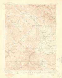
1937 Map of Taylor Park
USGS Topo · Published 1949About this map
The Continental Divide crests along the northeast corner of this high-altitude landscape, marking the boundary between the Gunnison National Forest and the Sawatch Mountains. Mining activity is heavily documented throughout the central peaks, with notable operations such as the Enterprise Mine, Pieplant Mine, and Forest Hill Mine appearing alongside their respective processing sites like the Pieplant Mill. These industrial pockets are connected by a network of early mountain paths, including the Forest Hill Trail and Matchless Trail, which traverse the dramatic vertical relief of American Flag Mtn and Baldy Mtn.
Find a feature on this map
72 named features on this map. Tap any name to fly to it.
Don’t see what you’re looking for? This feature index may not catch every label — zoom into the map to look around manually.
Map Details
Editions of this 1937 Taylor Park Map
3 editions found

Other maps of this area

1888 · Crested Butte
USGS Topo · 1:62,500

1889 · Crested Butte
USGS Topo · 1:62,500

1889 · Leadville
USGS Topo · 1:125,000

1891 · Leadville
USGS Topo · 1:125,000

1893 · Crested Butte
USGS Topo · 1:62,500

1893 · Aspen
USGS Topo · 1:62,500

1895 · Aspen
USGS Topo · 1:62,500

1909 · Mount Jackson
USGS Topo · 1:125,000

1911 · Mount Jackson
USGS Topo · 1:125,000

1934 · Taylor Park
USGS Topo · 1:62,500