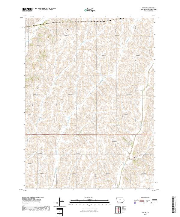
2022 Map of Taylor
USGS Topo · Published 2022About this map
York Township Cem sits along Lombardy Rd in this section of Pottawattamie County, where the agricultural landscape is defined by the parallel drainage of several creeks. The terrain is deeply grooved by Keg Cr, Little Silver Cr, Middle Silver Cr, and Silver Cr, all flowing generally southward across the township lines. This pattern of water and ridge has historically dictated the placement of rural infrastructure, visible in the grid of section roads like Elmtree Rd and Hickory Rd that navigate the high ground between these waterways. The small settlement of Taylor appears near the southeastern corner, serving as a focal point for the surrounding farmsteads. This modern survey reflects the enduring cadastral system and the continued dominance of large-scale agriculture in western Iowa.
Find a feature on this map
19 named features on this map. Tap any name to fly to it.
Don’t see what you’re looking for? This feature index may not catch every label — zoom into the map to look around manually.
Map Details
Editions of this 2022 Taylor Map
This is the sole edition of this map. No revisions or reprints were ever made.
Other maps of this area

1954 · Omaha
USGS Topo · 1:250,000

1956 · Underwood
USGS Topo · 1:24,000

1956 · Mineola
USGS Topo · 1:24,000

1956 · Neola
USGS Topo · 1:24,000

1956 · Treynor
USGS Topo · 1:24,000

1956 · Mc Clelland
USGS Topo · 1:24,000

1957 · Omaha
USGS Topo · 1:250,000

1957 · Taylor
USGS Topo · 1:24,000

1958 · Omaha
USGS Topo · 1:250,000

1963 · Avoca NW
USGS Topo · 1:24,000