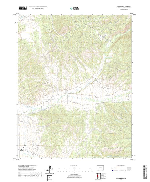
2022 Map of Taylor Ranch
USGS Topo · Published 2022About this map
The settlements of Chama and Los Fuertes anchor this portion of the Culebra Creek valley in Costilla County. Located in the high Sangre de Cristo foothills, the landscape is defined by traditional water management systems like Cerro Ditch Number 1 and the Sanchez Canal, which divert water from peaks to irrigate the valley floor. Genealogists will find the Chama Cem and Los Fuertes Cem well-documented near their respective communities.
Find a feature on this map
37 named features on this map. Tap any name to fly to it.
Don’t see what you’re looking for? This feature index may not catch every label — zoom into the map to look around manually.
Map Details
Editions of this 2022 Taylor Ranch Map
This is the sole edition of this map. No revisions or reprints were ever made.
Other maps of this area

1954 · Trinidad
USGS Topo · 1:250,000

1955 · Trinidad
USGS Topo · 1:250,000

1958 · Trinidad
USGS Topo · 1:250,000

1959 · Trinidad
USGS Topo · 1:250,000

1967 · San Luis
USGS Topo · 1:24,000

1967 · La Valley
USGS Topo · 1:24,000

1967 · Fort Garland SW
USGS Topo · 1:24,000

1967 · Ojito Peak
USGS Topo · 1:24,000

1967 · Taylor Ranch
USGS Topo · 1:24,000
1967 · Culebra Peak
USGS Topo · 1:24,000