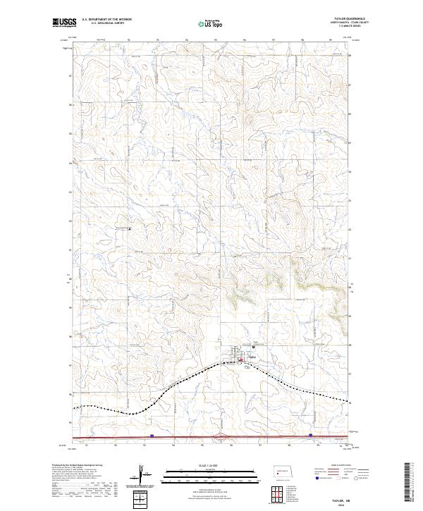
2024 Map of Taylor
USGS Topo · Published 2024About this map
The town of Taylor serves as the focal point of this Stark County landscape, situated along the southern edge of the northern plains. The map illustrates a highly organized township and range system, with a dense grid of rural roads like 97th Ave SW and 35th St SW defining the agricultural character of the region. Local genealogy is anchored by the Taylor Lutheran Cem near the town center and the Immanuel Cem further to the northwest, providing specific points of interest for family history researchers. Drainage for these rolling fields is provided by Beaver Creek and Government Creek, which weave through the southern sections. This 2024 survey reflects the enduring layout of the North Dakota prairie, showing how modern infrastructure follows the historic section lines established by early surveyors.
Find a feature on this map
32 named features on this map. Tap any name to fly to it.
Don’t see what you’re looking for? This feature index may not catch every label — zoom into the map to look around manually.
Map Details
Editions of this 2024 Taylor Map
This is the sole edition of this map. No revisions or reprints were ever made.
Other maps of this area

1953 · Dickinson
USGS Topo · 1:250,000

1953 · Watford City
USGS Topo · 1:250,000

1957 · Dickinson
USGS Topo · 1:250,000

1957 · Watford City
USGS Topo · 1:250,000

1967 · Watford City
USGS Topo · 1:250,000

1973 · Bratburg Butte
USGS Topo · 1:24,000

1973 · Marshall SE
USGS Topo · 1:24,000

1973 · Boyle
USGS Topo · 1:24,000

1973 · Taylor
USGS Topo · 1:24,000

1973 · Marshall SW
USGS Topo · 1:24,000