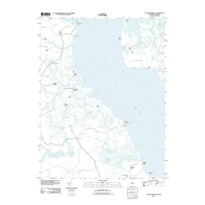
2011 Map of Taylors Bridge
USGS Topo · Published 2011About this map
Saint Augustine Landing and Fennimore Landing define the marshy Delaware River coastline in this 2011 map, where the complex waterways of the Appoquinimink River and Blackbird Creek reach the bay. The landscape is marked by historical river access points like Thomas Landing and Stave Landing, connected by narrow roads such as Vance Neck Rd and Cedar Swamp Rd. Navigational history is evident at the Appoquinimink Range Lights, while the interior shows the small settlement at Taylors Bridge. The eastern shoreline includes notable features like Artificial Island and Baker Shoal, contrasting with the extensive wetland drainage systems of the River Shore Ditch and The Big Ditch. This document captures the coastal geography of the region before further environmental and infrastructure changes altered these historic landing sites.
Find a feature on this map
51 named features on this map. Tap any name to fly to it.
Don’t see what you’re looking for? This feature index may not catch every label — zoom into the map to look around manually.
Map Details
Editions of this 2011 Taylors Bridge Map
This is the sole edition of this map. No revisions or reprints were ever made.
Other maps of this area

1890 · Salem
USGS Topo · 1:62,500

1890 · Bay Side
USGS Topo · 1:62,500

1894 · Bay Side
USGS Topo · 1:62,500

1898 · Salem
USGS Topo · 1:62,500

1899 · Vineland
USGS Topo · 1:125,000

1899 · Dover
USGS Topo · 1:125,000

1901 · Camden
USGS Topo · 1:125,000

1904 · Wilmington
USGS Topo · 1:62,500

1906 · Dover
USGS Topo · 1:125,000

1906 · Wilmington
USGS Topo · 1:62,500