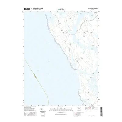
2016 Map of Taylors Island
USGS Topo · Published 2016About this map
The intricate marshlands of Dorchester County define this coastal landscape, where the Taylors Island and Smithville settlements represent the primary points of human habitation. This 2016 survey illustrates a fragile geography of necks and points, including Hooper Neck, Robinson Neck, and Meekins Neck, separated by an expansive network of waterways like Davis Creek and Parsons Creek. The reliance on local maritime history is evident in the naming of coastal features such as Cators Cove and Chapel Cove, while the interior marshes like Piney Neck Marsh and Hog Marsh show the influence of the tides on the land's structure. Local heritage is grounded in sites like Bethlehem Cem and Grace Cem, which remain as fixed points amidst the shifting wetlands. The western portion of the map is dominated by the vast Chesapeake Bay, marked by the Intracostal Waterway, which serves as a vital shipping lane alongside the labyrinthine tidal creeks and islands.
Find a feature on this map
57 named features on this map. Tap any name to fly to it.
Don’t see what you’re looking for? This feature index may not catch every label — zoom into the map to look around manually.
Map Details
Editions of this 2016 Taylors Island Map
This is the sole edition of this map. No revisions or reprints were ever made.
Other maps of this area

1892 · Drum Point
USGS Topo · 1:62,500

1893 · Sharps Island
USGS Topo · 1:62,500

1898 · Choptank
USGS Topo · 1:125,000

1898 · St. Marys
USGS Topo · 1:125,000

1901 · Drum Point
USGS Topo · 1:62,500

1904 · Sharps Island
USGS Topo · 1:62,500

1904 · Oxford
USGS Topo · 1:62,500

1905 · Crapo
USGS Topo · 1:62,500

1905 · Drum Point
USGS Topo · 1:62,500

1906 · St. Marys
USGS Topo · 1:125,000