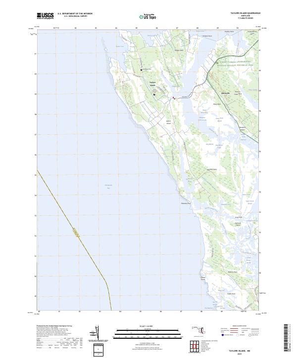
2023 Map of Taylors Island
USGS Topo · Published 2023About this map
Harriet Tubman Underground Railroad National Historical Park anchors the northeastern reaches of this coastal landscape, protecting a vital legacy within the marshes of Dorchester County. The terrain is a complex network of peninsulas and tidal wetlands, where landforms like Susquehanna Neck, Hooper Neck, and Meekins Neck are separated by intricate waterways such as Slaughter Creek and Punch Island Creek. The namesake community of Taylors Island serves as a central hub, connected by Taylors Island Rd and surrounding the Grace Episcopal Cem.
Find a feature on this map
67 named features on this map. Tap any name to fly to it.
Don’t see what you’re looking for? This feature index may not catch every label — zoom into the map to look around manually.
Map Details
Editions of this 2023 Taylors Island Map
This is the sole edition of this map. No revisions or reprints were ever made.
Other maps of this area

1892 · Drum Point
USGS Topo · 1:62,500

1893 · Sharps Island
USGS Topo · 1:62,500

1898 · Choptank
USGS Topo · 1:125,000

1898 · St. Marys
USGS Topo · 1:125,000

1901 · Drum Point
USGS Topo · 1:62,500

1904 · Sharps Island
USGS Topo · 1:62,500

1904 · Oxford
USGS Topo · 1:62,500

1905 · Crapo
USGS Topo · 1:62,500

1905 · Drum Point
USGS Topo · 1:62,500

1906 · St. Marys
USGS Topo · 1:125,000