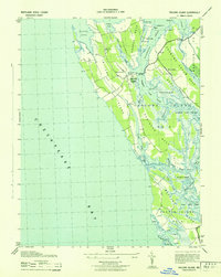
1943 Map of Taylors Island
USGS Topo · Published 1943About this map
Taylors Island and the surrounding Chesapeake marshlands are captured here during World War II, revealing a landscape defined by intricate waterways and fragmented necks of land. This survey, compiled from air photographs by the U. S. Coast and Geodetic Survey, shows a community deeply tied to the water, where small settlements like Smithville and Taylors Island are linked by rural roads and coastal landmarks. The presence of Bethlehem Church and Grace Church suggests established centers of local life amidst the vast tidal creeks.
Find a feature on this map
68 named features on this map. Tap any name to fly to it.
Don’t see what you’re looking for? This feature index may not catch every label — zoom into the map to look around manually.
Map Details
Editions of this 1943 Taylors Island Map
This is the sole edition of this map. No revisions or reprints were ever made.
Other maps of this area

1892 · Drum Point
USGS Topo · 1:62,500

1893 · Sharps Island
USGS Topo · 1:62,500

1898 · Choptank
USGS Topo · 1:125,000

1898 · St. Marys
USGS Topo · 1:125,000

1901 · Drum Point
USGS Topo · 1:62,500

1904 · Sharps Island
USGS Topo · 1:62,500

1904 · Oxford
USGS Topo · 1:62,500

1905 · Crapo
USGS Topo · 1:62,500

1905 · Drum Point
USGS Topo · 1:62,500

1906 · St. Marys
USGS Topo · 1:125,000